
Kashechewan First Nation flood-risk forecasting and mitigation
Hatch-developed tools reduce life-threatening flood risk for remote community
Kashechewan First Nation | Canada | 2008-2018
2018 Award of Excellence
Canadian Consulting Engineering Awards
8 evacuations in the last 40+ years
5 km long ring dyke
2,000 residents under threat
Challenges
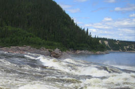
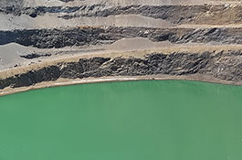
- Remote, 2,000-person community is located on the Lower Albany River Delta, and is prone to flooding.
- Each year an ice “dam” forms near the mouth of the river causing river levels to rise rapidly, and sometimes significantly.
- When this occurs, the only thing that stands between the community's 2,000-plus residents and these destructive, life-threatening ice jam floods is the five-kilometre-long Kashechewan ring dyke. In the spring of 2006 the ring dyke was almost overtopped, which would have released a wall of water engulfing the entire community in a matter of minutes.
- In just over 40 years, the community has had to evacuate eight times, the most recent being in 2017, as result of life-threatening flood risks.
Solutions
- We have developed two innovative tools to minimize this life-threatening risk.
- A first-of-its-kind quantitative dam safety risk assessment tool was designed to provide a scientifically defendable assessment of the likelihood of dam failure.
- We've also developed a unique flood forecast system specifically for the community that, in combination with traditional knowledge, provides a ten-day forecast of the potential for ice jam flooding and the subsequent risk to human lives and infrastructure.
- The tools provide a clear understanding of the risks that the community faces and a means to reduce the risks to tolerable levels.
Highlights
- Award of Merit Ontario Consulting Engineering Awards
- The flood forecasting tool provides a ten-day forecast of the potential for ice jam flooding, and provides the required lead time should evacuation of the community be necessary.
- During the spring flood, travel to the remote community is only possible by air. Evacuation of the 2,000 person community takes days and is not possible during inclement weather, making forecasting incredibly important.
- Over a period of eight years, the tool has proven to provide a reliable method for assembling, manipulating, and summarizing readily available data to support a rational assessment of the potential for ice jam flooding and the need for evacuation. The success of the tool is evidenced by the fact that Ontario’s Ministry of Natural Resources and Forestry want to take ownership of it for Kashechewan and commission Hatch to develop similar tools for other sites.
- Our tools have enhanced safety, potentially reduced evacuation requirements, and, most importantly, led to the landmark “Agreement of Hope” that includes considerations to potentially relocate the flood-prone community.
"The Hatch team was instrumental in the successful delivery of the project, allowing the development of the first guideline that addresses the dam safety and the issues specific to assist in the development of a new dam."
Related services & technologies
How we can help you
If you have a problem that needs to be solved, please get in touch.
Related Projects
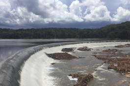

Wolbachia Mosquito Rearing Facilities
Brazil & Colombia

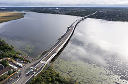
Kingston Third Crossing (Waaban Crossing)
Kingston, Ontario, Canada
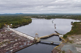
Grand Falls Dam and Spillway Rehabilitation
Grand Falls, Newfoundland, Canada
Water sampling at depth with drones
Canada, USA

Burnhamthorpe Water Project
Canada

Vaudreuil 2022 ― Phase I
Canada
See All